7 Fan-Made Theories About Suga BTS' Face Scar in 'Daechwita' MV: Inspired by the Movie 'SCARFACE' - Becoming a Time Traveler
Attracting attention, fans came up with these 7 theories about Suga BTS' face scar in the Daechwita MV. What are they?
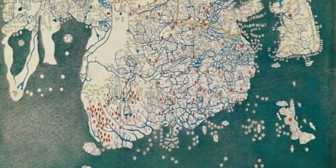
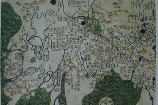
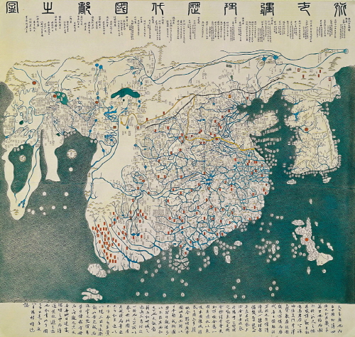
Kapanlagi.com - One of South Korea's world-class heritages is the Afro-Eurasia map. This map is a world map drawn in the early 15th century. The map named Gangnido has the meaning of a world map that must be known.
Gangnido itself is an abbreviation of Honil-Gangni-Yeokdae-Gukdo-Jido. This map was made in 1402, about 10 years after the establishment of the Joseon Dynasty. The map, created by the Deputy Prime Minister, combines various maps from Korea, China, and Japan. Not only that, Africa is also included, making it over 100 years older than any map in Europe.
Gangnido Map © blog.naver.com
As mentioned earlier, this map includes Africa in it. It is even depicted in detail, such as the African Coast and the Nile River. Of course, this makes Gangnido an unparalleled map in that era.
The existence of Gangnido, created at that time, made Joseon (Korea) exceptionally knowledgeable about the world. This demonstrates the high level of literacy, knowledge, and culture possessed by the Joseon dynasty.
© contents.history.go.kr
As reported by the Voluntary Agency Network of Korea (VANK), it is known that this map was used as a cover for the book 'the History of Cartography in the Traditional East and Southeast Asian Societies' published by the University of Chicago Press.
Even in another book, 'Cartographia: Mapping Civilizations' written by Vincent Virga and the U.S. Library of Congress, it is evaluated that no map can be compared to Gangnido! English historian Joseph Needham also praised Gangnido as the best map of that time.
(kpl/mit)
Cobain For You Page (FYP) Yang kamu suka ada di sini,
lihat isinya
Attracting attention, fans came up with these 7 theories about Suga BTS' face scar in the Daechwita MV. What are they?

Getting more recognized, let's get to know the unique Korean YouTuber named Jang Hansol.

National Children's Day, or known as Eorini Nal in the Korean language, is commemorated on May 5th. What is the history of this special day in Korea?
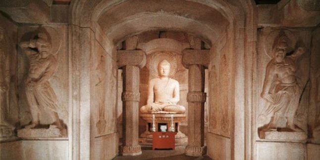
Unlike natural cave temples commonly found in China and India, Seokguram is an artificial cave temple that showcases advanced architectural techniques from the Silla Kingdom era.
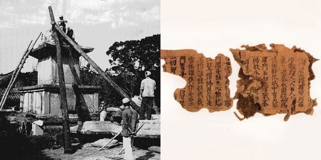
How did Silla manage to print the oldest document in the world?
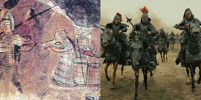
Have you ever seen a Korean sageuk or epic drama? Or for Korean drama and film lovers, do you still remember the movie The Great Battle starring Jo In Sung and Nam Joo Hyuk? Have you heard of Gaema Musa? What is it?
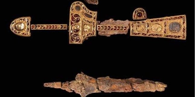
This dagger is believed to have been made by Roman goldsmiths as it is decorated with ancient Greek and Mediterranean spiral patterns. However, how did a dagger made in Eastern Europe end up in Korea?
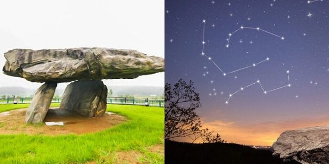
Did you know that Korea is the center of dolmens in the world? This is what makes the dolmens found in Korea become World Heritage Sites. Why is that?

There are many ancient superstitions still believed by the Korean people. Can drinking soju really make you single?

Korea is not only interesting with its boy groups and dramas. The masculinity culture in Korea is also a must-know for broadening insights.
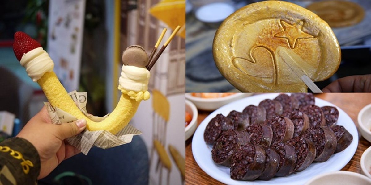
Said to be delicious, these Korean snacks are considered unique and strange for Indonesians.
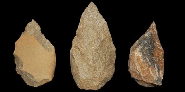
Did you know that Korea is rewriting the history of the Old Stone Age?